Terms and Conditions
Last updated: 18-08-2026
1. Preamble and Acceptance
These Terms and Conditions ("Terms") explain the rules for using the Vasu Terra Solutions website (the "Website") and for engaging our geographic information system (GIS), remote-sensing, environmental consulting and related professional services (the "Services"). The Services are provided by Insert Legal Name of Proprietor/Entity, trading as "Vasu Terra Solutions" ("Vasu Terra Solutions", the "Firm", "we", "us" or "our"). Anyone who engages our Services is referred to as the "Client", "you" or "your".
By using the Website, sending us an enquiry, accepting a proposal or quotation, or otherwise engaging our Services, you agree to these Terms and our Privacy Policy. If you do not agree, please do not use the Website or engage our Services. A signed engagement letter, statement of work or project-specific agreement (an "Engagement Agreement") may add to or change these Terms. If there is a conflict, the Engagement Agreement will take priority.
2. Website Use and Prohibited Activities
You may use the Website only for lawful purposes and in line with these Terms. You must not, and must not help anyone else to:
- use the Website in a way that could disable, overload, damage or disrupt it, or interfere with anyone else's use;
- try to gain unauthorised access to any part of the Website, another account, or any connected computer system or network;
- introduce viruses, malware, trojans or any other harmful material;
- use robots, spiders, scrapers or other automated tools to access, monitor, copy, extract or reproduce Website content, maps, imagery, data or materials without our prior written permission;
- copy, republish, frame, mirror, distribute or commercially exploit Website content, maps or materials without our prior written permission; or
- misrepresent your identity or affiliation or use the Website to send unauthorised advertising or promotional material.
If we reasonably believe that someone has breached this clause, we may restrict, suspend or end their access to the Website. We may also pursue any legal remedies available to us, including an injunction, where Website content has been scraped or reused without permission.
3. Proposal, Quotation and Project-Scope Process
An enquiry does not create a binding engagement. After receiving an enquiry, we may send a written proposal or quotation describing the scope, deliverables, fees, timeline and key assumptions (the "Proposal"). An engagement becomes binding only when the Client accepts the Proposal in writing, including by email, or signs an Engagement Agreement, as applicable. A Proposal remains valid for the period stated in it. If no period is stated, it remains valid for thirty (30) days from its issue date.
4. Fees, Taxes, Payment Milestones and Late Payment
The fees for the Services will be stated in the relevant Proposal or Engagement Agreement. Unless expressly stated otherwise, fees do not include applicable taxes, including Goods and Services Tax (GST). The Client must pay all applicable taxes at the rate in force on the invoice date, in addition to the stated fees.
Unless we agree otherwise in writing, payments are due according to the milestones stated in the Proposal or Engagement Agreement, such as an advance or mobilisation payment, interim milestone payments and final payment on delivery. Invoices must be paid within 10 days from the invoice date, unless the invoice or Engagement Agreement states a different period.
Overdue amounts will carry interest at 18% per annum or the highest rate allowed by law, whichever is lower, from the due date until payment is received. If payment remains outstanding for 15 days after the due date, we may suspend work, withhold deliverables or end the engagement, without affecting any other rights or remedies available to us.
5. Cancellation, Refund and Termination
Either party may end an ongoing engagement by giving 7 days' written notice. The Client must still pay for all work completed, expenses incurred and non-cancellable third-party commitments, including data licences, up to the termination date. Payments for completed work and for third-party data, licences or resources already purchased for the Client are non-refundable. If the Client cancels an accepted Proposal before work begins, we may charge 12% to cover administrative and planning costs already incurred.
We may end an engagement immediately by written notice if the Client fails to pay an amount when due, provides materially inaccurate project data, breaches these Terms, or acts unlawfully or fraudulently, or in a way that exposes the Firm to legal or regulatory risk.
6. Client Responsibility for Accurate Project Data
The Client must provide complete, accurate and timely information and materials reasonably needed for the Services, including data, GIS files, coordinates, maps, survey records, site access and approvals ("Client Data"). The Client confirms that it has all rights, licences and permissions needed to share the Client Data with us and allow us to use it for the engagement. We are not responsible for delays, errors or deficiencies in the deliverables caused by Client Data that is incomplete, inaccurate, outdated or unlawfully obtained.
7. Project Timelines
Any timeline in a Proposal or Engagement Agreement is an estimate. Delivery may depend on matters outside our control, including the timely receipt of Client Data and approvals, satellite revisit frequency, the availability of cloud-free imagery, weather, field-access permissions, ground-truthing requirements, and the Client's timely review and approval at each stage. If we expect a material delay, we will inform the Client and provide a revised timeline as soon as reasonably practical. We are not liable for delays caused by these factors.
8. Revisions and Out-of-Scope Changes
Unless the Proposal or Engagement Agreement states otherwise, the Client may request 3 rounds of revisions, provided the revisions stay within the agreed scope. Additional revisions, or changes to the scope, methodology, data sources, area of interest or deliverable format, will be treated as a change order. We will quote and charge for that work separately, and will begin only after both parties agree to it in writing.
9. Acceptance of Final Deliverables
The Client must review the final deliverables and report any deficiency in writing within 10 business days after delivery. If we do not receive such notice within that period, the deliverables will be treated as accepted. We will correct deficiencies within the agreed scope at no additional charge. A request caused by a later change in scope, requirements or Client Data will be handled as a change order under clause 8.
10. Ownership of Reports, Maps, Code, Models and Methodologies
Once all fees have been paid, the Client will own the final deliverables created specifically for the engagement, including project-specific reports, maps and datasets, for the purpose for which they were commissioned. We continue to own our pre-existing or independently developed methodologies, models, algorithms, scripts, code, templates, tools and know-how, together with any improvements or derivatives, even if they are used or developed during the engagement. Where any of these materials are embedded in a deliverable, the Client receives a non-exclusive, non-transferable licence to use them only for its own internal use in connection with the project. They may not be resold, sublicensed or used for competing engagements unless we agree otherwise in writing.
11. Third-Party Dataset Licensing
Our deliverables may use or be derived from third-party geospatial data, including Sentinel and Landsat imagery, data processed through Google Earth Engine, and other open or licensed datasets ("Third-Party Data"). The use of Third-Party Data and any related deliverable remain subject to the original provider's licence terms, attribution requirements and restrictions, such as the Copernicus/Sentinel Data Terms, the USGS/Landsat data policy and the Google Earth Engine Terms of Service. We cannot give the Client rights beyond those granted by the original provider. The Client is responsible for ensuring that its intended use complies with all applicable third-party terms.
12. Confidentiality
Each party must protect any non-public information received from the other in connection with an engagement, including Client Data, project locations, deliverables, pricing and business information ("Confidential Information"). Confidential Information may be shared only with employees, sub-consultants or professional advisers who need it and are bound by equivalent confidentiality duties; with the disclosing party's prior written consent; or when required by Applicable Law, a court order or a regulatory authority. This duty continues for 2 years after the engagement ends. Confidentiality obligations relating to sensitive Client Data or project locations continue indefinitely.
13. Regulated and Sensitive Geospatial Data
The Client understands that Indian law restricts the survey, mapping, collection and sharing of certain geospatial data, including information about defence installations, critical infrastructure, border areas and other regulated categories. These restrictions include the National Geospatial Policy, 2022, and related guidance from the Department of Science and Technology and other competent authorities. We will not survey, process or share regulated geospatial data unless all required approvals and legal requirements are met. The Client must not ask us to act otherwise and must tell us promptly if a project involves, or may reasonably involve, regulated geospatial data.
14. Remote-Sensing Limitations and Field Verification
Remote-sensing and GIS analysis has inherent limitations. Results may be affected by sensor resolution, cloud or atmospheric interference, gaps between satellite passes, modelling or classification uncertainty, and the accuracy of reference and ground-truth data. Desk-based and remote-sensing deliverables do not replace field investigation, ground surveys or physical verification. They should be verified in the field before being used for decisions with significant financial, safety, legal or regulatory consequences.
15. No Guarantee of Outcomes
We provide our analysis, modelling and advice with reasonable skill and care. However, we cannot guarantee the presence, quantity or quality of groundwater or any other natural resource; the approval of any licence, environmental clearance or permission by an authority; or the commercial, financial or investment result of a project or decision based on our deliverables. These outcomes depend on matters outside our control, including natural conditions, regulatory decisions and market conditions.
16. Client Responsibility for Final Decisions
The Client is responsible for all final engineering, legal, construction, land-acquisition, investment and regulatory-compliance decisions made using our deliverables. Before acting, the Client must obtain independent advice from suitably licensed engineers, architects, advocates, statutory auditors or other professionals where appropriate. Our deliverables support decision-making; they are not engineering designs, legal advice or a replacement for any statutory certification required from a licensed professional.
Important Disclaimer
Our geospatial analyses and suitability assessments support decision-making. They are based on the data, methods, resolution and assumptions described in the relevant project report. They do not replace field investigation, statutory approval, engineering design or advice from a licensed professional where required.
17. Warranty Disclaimer and Limitation of Liability
Except where these Terms or an Engagement Agreement expressly state otherwise, the Services and deliverables are provided on an "as is" basis. To the fullest extent allowed by Applicable Law, we exclude all express and implied warranties, including warranties of merchantability, fitness for a particular purpose and non-infringement.
To the fullest extent allowed by Applicable Law: (a) our total liability arising from an engagement, whether in contract, tort (including negligence), statute or otherwise, will not exceed the fees actually paid by the Client for the specific Services that gave rise to the claim; and (b) we will not be liable for indirect, incidental, consequential, special or punitive losses, or for loss of profit, revenue, business, data or goodwill, even if we were told that such loss was possible. Nothing in these Terms excludes or limits liability where the law does not allow it, including liability for death or personal injury caused by negligence, or for fraud.
18. Indemnity
The Client will indemnify and protect us against claims, losses, liabilities, damages, costs and reasonable legal fees arising from: (a) Client Data or Third-Party Data selected or supplied by the Client that is inaccurate, unlawfully obtained, unlicensed or provided in breach of another person's rights; (b) the Client's use of deliverables in breach of these Terms, an Engagement Agreement or applicable Third-Party Data licence terms; or (c) the Client's breach of clause 13 on Regulated and Sensitive Geospatial Data.
19. Force Majeure
Neither party is responsible for a failure or delay caused by events beyond its reasonable control. These may include natural disasters, pandemics, war, civil unrest, government action, satellite or data-provider outages, internet or telecommunications failures, or a third party's refusal of field access (a "Force Majeure Event"). The affected party must notify the other promptly and resume performance as soon as reasonably practical. If the event continues for more than 60 days, either party may end the affected engagement by written notice. The Client must still pay for work completed up to the termination date.
20. Governing Law, Dispute Resolution and Jurisdiction
These Terms and any dispute connected with them, including a non-contractual dispute, are governed by the laws of India. The parties will first try to resolve the dispute through good-faith negotiation within 60 days after written notice. If they cannot resolve it, the dispute will be finally settled by arbitration under the Arbitration and Conciliation Act, 1996. The arbitration will be seated in Mumbai, Maharashtra, conducted in English, and heard by one arbitrator jointly appointed by the parties. Subject to the arbitration requirement, the courts at Mumbai, Maharashtra, will have exclusive jurisdiction over matters that cannot be referred to arbitration and supervisory jurisdiction over the arbitration.
21. Updates, Severability, Waiver, Assignment and Entire Agreement
21.1 Updates
We may update these Terms from time to time. The "Last updated" date shows when the current version took effect. Updated Terms apply once they are posted on the Website and will govern engagements entered into after that date. An engagement already in progress will continue under the Terms that applied when the relevant Proposal was accepted, unless the parties agree otherwise in writing.
21.2 Severability
If a court or arbitral tribunal finds any part of these Terms invalid, illegal or unenforceable, that part will be removed and the rest of the Terms will remain in effect.
21.3 Waiver
A party does not waive a right by delaying or failing to exercise it. Exercising a right once, or only in part, does not prevent that party from exercising it again or using any other right.
21.4 Assignment
The Client may not assign, transfer or subcontract its rights or obligations under these Terms without our prior written consent. We may assign or subcontract some or all of our rights or obligations to an affiliate, successor or sub-consultant involved in delivering the Services, provided that any sub-consultant is bound by confidentiality obligations at least as protective as these Terms.
21.5 Entire Agreement
These Terms, the applicable Proposal or Engagement Agreement, and our Privacy Policy form the entire agreement between the parties on their subject matter. They replace all earlier oral or written discussions, representations and agreements, except in the case of fraudulent misrepresentation.
22. Contact Information
If you have any questions about these Terms, please contact us using the details below:
- Legal / Trading Name
- "Vasu Terra Solutions"
- Business Address
- 12A, Gokuldham Apartments, Kashiko Nagar, Krushnaban Colony, CIDCO, Nashik - 422009
- Telephone
- +91 81494 23884
Last updated: 18/08/2026
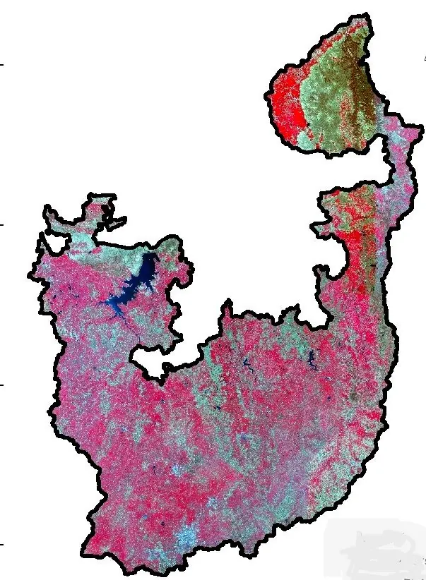
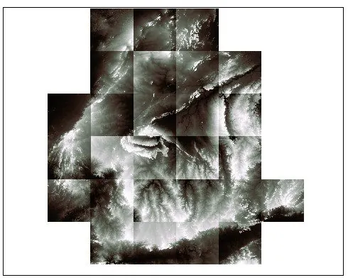 Raw satellite tiles, pre-mosaic
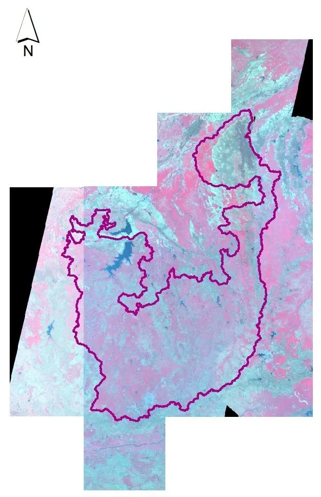 Band stacking & mosaicking in progress